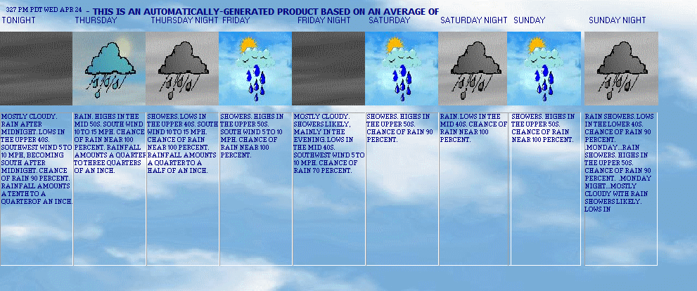
TODAY
Today Mostly cloudy with a 50 percent chance of rain. highs around 50. southeast wind 5 to 10 mph. rainfall amounts less than a tenth of an inch.
TONIGHT
Tonight Mostly cloudy with a 50 percent chance of rain. lows in the lower 40s. winds light. rainfall amounts less than a tenth of an inch.
MONDAY
Monday Mostly cloudy in the morning, then becoming partly sunny. a 50 percent chance of rain. highs in the mid 50s. winds light. rainfall amounts less than a tenth of an inch.
MONDAY NIGHT
Monday night Mostly cloudy. patchy fog after midnight. lows around 40. winds light in the evening, becoming light and variable.
TUESDAY
Tuesday Patchy fog in the morning. mostly sunny. highs in the mid 50s. light and variable winds.
TUESDAY NIGHT
Tuesday night Partly cloudy. patchy fog. lows in the upper 30s.
WEDNESDAY
Wednesday Partly sunny. patchy fog. highs in the lower 50s.
NWS Forecast: 145 AM PST SUN JAN 11
Tide info
Tacoma Narrows
My Tacoma Washington Forecast


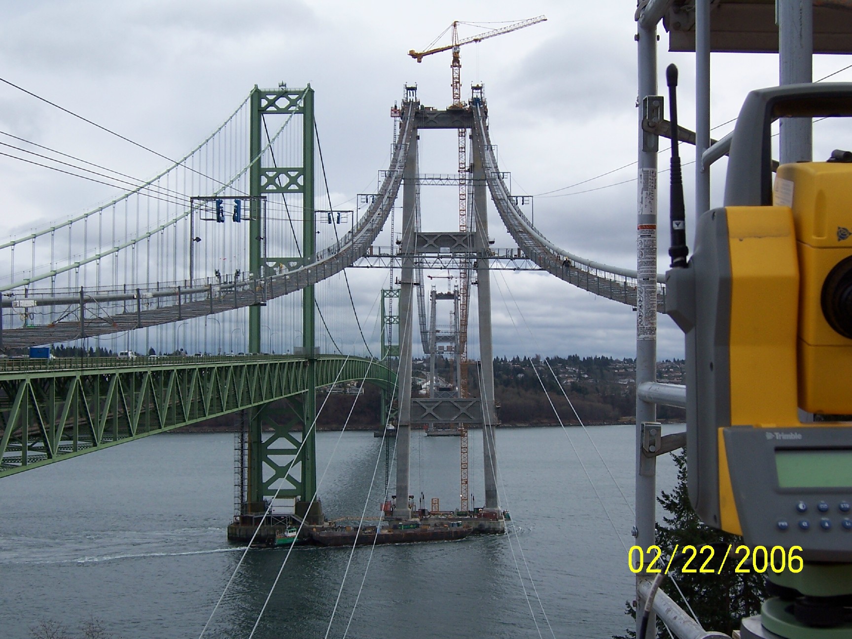
Surveying
and Building the
Tacoma Narrows Bridge Site 2002 to 2008
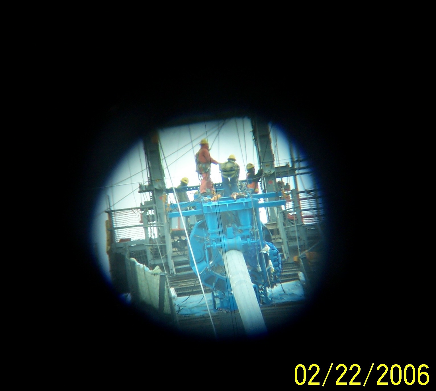
I held my digital
camera at the eye piece of our 32 power Trimble survey instrument shown in the first picture
and snapped this picture of the Iron workers rigging this compactor off of the
Gig Harbor Tower, south side.
[Home]
[Kalama Display Live]
[My Tacoma Washington Forecast.html]
[THE WOODLAND,KALAMA, KELSO-LONGVIEW FORECAST]
[SE ALASKA, KETCHIKAN,GRAVINA ISLAND.html]
[Northern Hemisphere Animation]
[Tide INFO Tacoma Narrows Bridge, Washington]
[stock page.htm]
[weather data history]
[moon phase.htm]
[Vantage pro 2 ISS]
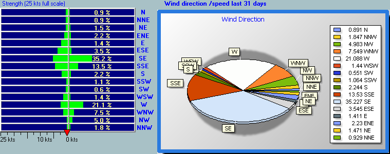
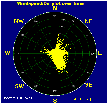
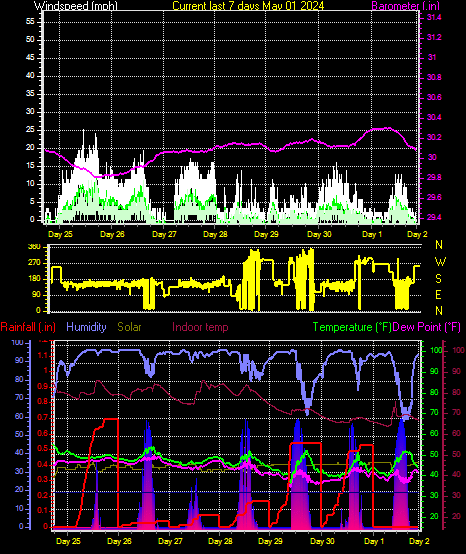
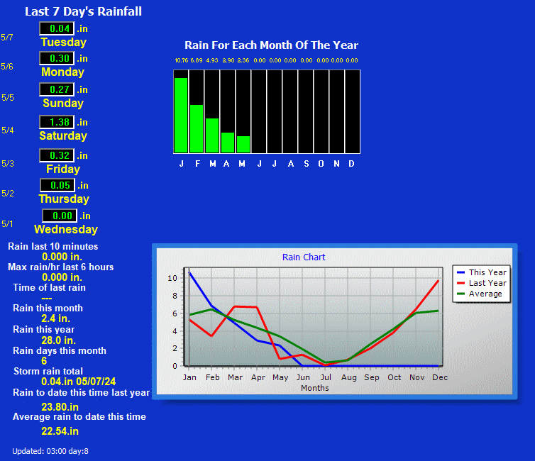
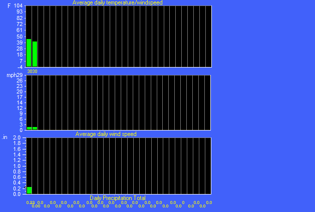
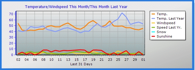
This is a Summary of the weather data at
my Weather Station 2 miles above I-5 at exit 27
[Home]
[Kalama Display Live]
[My Tacoma Washington Forecast.html]
[THE WOODLAND,KALAMA, KELSO-LONGVIEW FORECAST]
[SE ALASKA, KETCHIKAN,GRAVINA ISLAND.html]
[Northern Hemisphere Animation]
[Tide INFO Tacoma Narrows Bridge, Washington]
[stock page.htm]
[weather data history]
[moon phase.htm]
[Vantage pro 2 ISS]


